
Independence Neighbors by Block
A block search begins with the parcel map, then separates what a map displays from what it proves. Parcel layers can show the lots around an address and their current assessment context. A recorder instrument can identify a named party and legal description. Election information shows registration or district data under a specific statute. Civic maps describe a neighborhood boundary, not a household roster. Those distinctions keep an Independence neighbors search focused on public geography rather than assumptions about the people nearby.
| Source | What It Shows About a Block | Access |
|---|---|---|
| Jackson County Parcel Viewer | Parcel, legal description, owner and mailing display, districts, values, map tools, and adjacent geography | Online viewer; assessment and GIS context, not a certified title record |
| Jackson County Public Property Access | Real-property account context, address or owner search, values, and record-card functions | Online portal; a maintenance notice appeared during the research pass |
| Jackson County Recorder | Recorded party names, instruments, document numbers, and legal-description links | Online index and office or microfilm channels; copies follow recorder procedure |
| Missouri voter and election records | Registration or district information within legal limits, plus lawfully requested lists or maps | Exact-field lookup and Jackson County Election Board request channels |
| City neighborhood and HOA-district layers | Neighborhood geography, plats, footprints, and HOA-district clues | City GIS and neighborhood-program resources; not a membership roster |
An owner field and a mailing field can support a parcel lead, but neither establishes who is living at the physical address. The county distinguishes the situs, which is the physical location, from its mailing address. The county also warns that a prior owner can remain visible until assessment information updates.
Independence Parcel Layers Explained
The city’s property and records GIS services provide more than a street label. Available layers include address points, cadastral properties and records, plats, building footprints, land-trust and public-ownership parcels, neighborhoods, and homeowners-association districts. The county Parcel Viewer adds a parcel number, lot size, building information, land-use code, legal description, tax-code area, exemption, school, library, fire, water, and TIF district context. Each layer answers a geographic or assessment question.
A plat records the layout of lots or an addition. A building footprint is a mapped structure shape, not an occupancy record. An HOA-district layer can indicate a mapped administrative area, but it is not a membership directory. The county specifically directs easement, right-of-way, restriction, and plat questions to the recorder because GIS is not the keeper of easement records. A block map is most useful when the parcel number and legal description are retained alongside the map view.
Note: Map displays are current-reference tools. Preserve the access date and use a recorder document, not a layer label, when official proof is needed.
Map an Independence Block
Use an adjacent-parcel method for the immediate block. It does not create a list of residents. Instead, it documents which parcels touch or sit near the address and identifies the next official record to check. The same approach helps when a street boundary, city boundary, or legal description is unclear.
- Normalize the starting address with standard street abbreviations, directionals, ZIP, and the county’s autocomplete suggestions. If the address does not resolve, try the city address-point layer or the parcel number.
- Open the parcel in the Viewer and record the parcel number, situs, legal description, map location, source date, and any visible owner or mailing display.
- Click or identify the immediately surrounding parcels, keeping their parcel numbers separate. Compare plats, footprints, neighborhood boundaries, and district layers without inferring a relationship between lots.
- For a title question, search the recorder by legal description or named party and preserve the instrument number. For a full street-by-street record chain, use the Independence By Street directory.
Jackson County’s physical situs and mailing address are separate fields. A mailing address may be outside the block or shared among parcels. The current assessment display can also lag a recorded transfer. That is why a parcel screen is an orientation step for Independence neighbors, not a conclusion about a household.
Neighbors Sources and Limits
Official records state their custodian, fields, and access boundaries. Commercial people-search categories may combine old or mismatched material without showing the source date or the legal distinction between an owner, a mailing recipient, and an occupant. For a block question, keep the original public source and its access date instead of treating a compiled profile as confirmation.
| Official roll or record | Commercial people-search category | Practical limit |
|---|---|---|
| Parcel Viewer and property account | Compiled address or person listing | The official display has parcel and source context; neither proves who occupies a home. |
| Recorder instrument | Combined ownership history | A recorded party and legal description can be checked, while a summary may omit releases, dates, or changes. |
| Voter or election record | Neighborhood list | Missouri law limits fields and use; a voter result is not a complete block roster. |
| City neighborhood map | Association-contact list | A mapped district identifies geography, not members or private contact information. |
If a government display looks wrong, request correction guidance from the custodian. An opt-out request cannot remove a public government record, and a private-category removal process does not change the original custodian’s record. Preserve uncertainty rather than merging several unverified results into a claim about Independence neighbors.
Independence Voter Geography
Missouri voter records can describe civic geography, but they are not a general neighbor directory. RSMo 115.157 limits public electronic and printed voter fields and prohibits commercial use. The statute can allow fields such as a voter ID, name, year of birth, address, township, ward, precinct, districts, and party affiliation in the defined circumstances. It does not require those records to be posted online, and it does not identify every adult at a block address.
The official lookup needs exact registered first and last name, date of birth, last four digits of the Social Security number, and county selection. For an election record, map, voter-history item, or list that is lawfully available, the Jackson County Election Board provides a public-records request form with district, street, map, list, and delivery choices. The form says the board intends to respond by the end of the third business day unless a lawful delay is explained. Protected addresses, inactive registrations, moves, and jurisdiction boundaries all limit what a result means.
Independence Neighborhood Program Limits
The city’s neighborhood resources are useful for civic context. They identify programs and geographic organization, not a public list of people who live in a neighborhood. City neighborhood-council maps provide an official overlay. Neighborhood Watch materials use address maps, meeting and recognition material, and optional group rosters. The Appleton Avenue example in the city guidebook shows how a street can be a civic-map unit without making its residents public.
| Local resource | Useful block information | Roster finding |
|---|---|---|
| City neighborhood programs | Program and liaison context for Independence neighborhoods | No public neighborhood-association member roster was located in the research. |
| Neighborhood-council maps | Official geographic boundaries | Map boundaries do not identify members or households. |
| Neighborhood Watch materials | Address-map and meeting framework | Any group roster is optional, not a public resident list. |
| City HOA-district GIS layer | Geographic or administrative clue | An HOA district is not a membership directory. |
The Independence neighborhood programs page is the official starting point for the city program context.
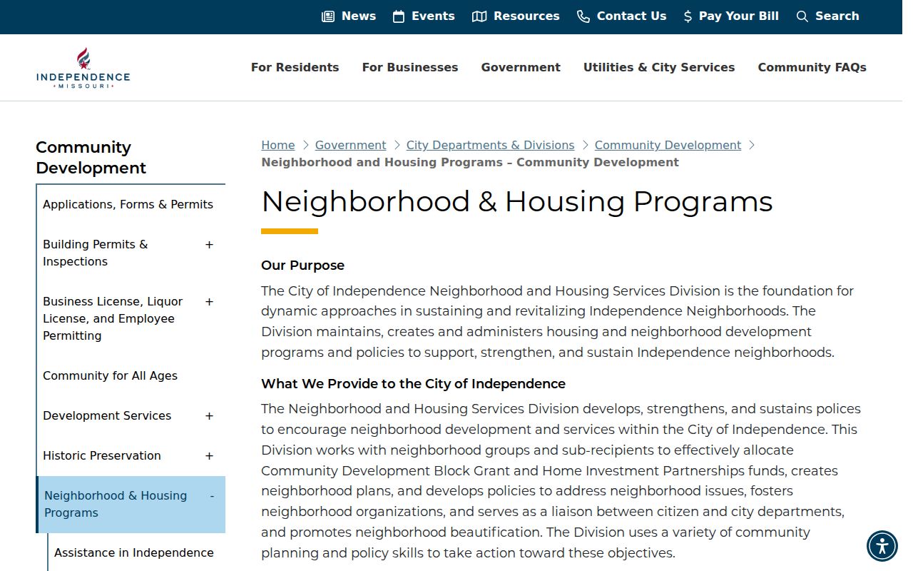
The capture documents the city’s program page, not a neighborhood-association directory. Contact a listed program or civic group through its public channel if a local question is appropriate; do not treat geographic participation as proof that a person lives at an address.
Independence Boundaries Around Blocks
Postal labels, city limits, and utility areas can overlap. The city GIS ZIP layer labels 64053 and 64054 as Independence/Sugar Creek and 64058 as Independence/Unincorporated. A ZIP is not a legal boundary or a substitute for parcel or voter jurisdiction. Determine the municipality from the city-limits layer, parcel data, or the address authority before deciding which office holds a record.
North Main shows why dated geography matters. The city says the area was annexed in 1851, developed from the 1870s into the early 1900s, and later received 1910s to 1930s subdivisions and bungalows. That history can explain a changing street or parcel context, but it does not establish who is now associated with a specific lot. Use the dated map or record that fits the question.
Note: A postal city label can help route mail, but it cannot establish city residence, owner status, or election jurisdiction.
County Jail Search Limits
The Jackson County inmate page is not a source for identifying Independence neighbors. The county says it provides selected current occupant information and expressly says it is not an arrest record, court record, or booking-record archive. It also excludes the Regional Correctional Center. Use Case.net for public court docket questions, preserve the access date and the county disclaimer, and do not turn a custody display into a general personal profile.
The Jackson County inmate-search page states its own terms and scope before use.
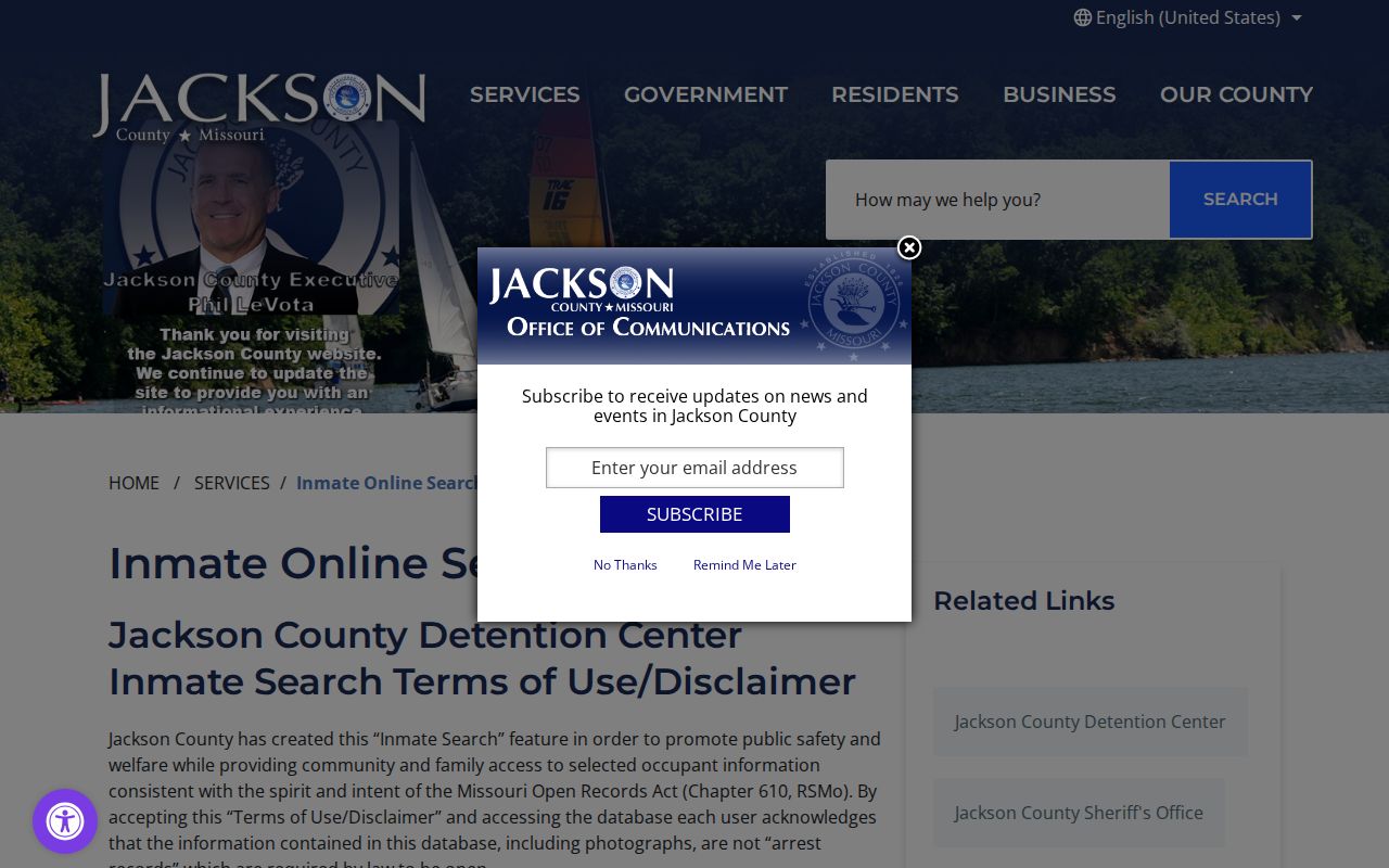
County information can change and people are presumed innocent. The page also states there is no commercial right to inmate images. Treat the capture as a scope reminder, not as a block-lookup tool or a replacement for a court record.
Privacy Limits for Neighbors
Public geography has firm privacy boundaries. A parcel or voter record does not reveal every household member, and a city service location is not a general residency record. Missouri Safe at Home gives qualifying survivors and household members a substitute address that government agencies and courts may accept. Do not seek to reverse that protection by combining separate records. Safe at Home is governed by RSMo §§589.660–589.681.
Do not publish or share full Social Security numbers, full driver-license numbers, medical information, financial-account details, sealed or secured court material, or nonpublic vital-record information. When an official record seems inaccurate, contact the keeper for correction or amendment instructions. A nearby parcel is a lead for a map question, not proof of family, contact, occupancy, or a relationship.
Lawful use. Independence neighbors research can support civic curiosity, public-property questions, and responsible neighborhood awareness. Never use it to watch, stalk, harass, intimidate, or harm another person.